Ecological Services - Wetland Delineation

We Are Environmental & Ecological Consultants.

The United States Environmental Protection Agency, through Section 404 of the Clean Water Act, authorizes the U.S. Army Corps of Engineers (USACE) to issue permits relating to the discharge of dredged or fill material into jurisdictional waters of the U.S., including wetlands. In most cases, authorizations for activities that impact wetlands and streams are obtained through either an individual or a nationwide permit issued by the USACE.

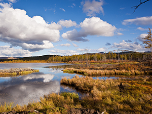
Wetland delineation is based on an evaluation of soil, vegetation and hydrologic conditions at a site. Our staff has the training and experience to evaluate all three ecosystem components required by the USACE. We are knowledgeable about permitting requirements and are experienced in dealing with the intricacies of the permitting process. We work closely with the USACE to address regulatory concerns at the earliest stages of a project.

  • Hand auger borings

    Delineation:

    Identification and field location of jurisdictional waters, including wetlands.
    • Soil, vegetation and hydrology documentation
    • Wetland boundary survey using GPS technology
    • Comprehensive report detailing permit options
  • Hand auger borings

    Permitting:

    Coordination of Nationwide and Individual permit submittal.
    • Wetland and stream impact documentation
    • Wetland and stream mitigation credit analyses
    • Alternative analyses formulation and presentation
    • Wetland and stream mitigation credit purchase coordination
    • On and off-site mitigation analyses (as applicable)
    • Natural stream channel design
    • Mitigation monitoring and plot sampling
  • Hand auger borings

    Buffer Variance:

    Georgia Waters of the State with evidence of base flow (connectivity to groundwater table) require a minimum 25-ft. buffer. Buffer variances are typically required for encroachment into the buffer for activities other than perpendicular road and utility line crossings.
  • Hand auger borings

    Additional Services

    • Pre/post development watershed assessments
    • Benthic (pond) sediment surveys
    • Down-stream Impact/sedimentation surveys
    • GPS Mapping of site features

Project List:

Sanitary Sewer Line, Troup and Meriwether Counties, Georgia

AES completed a wetland delineation on a proposed 20,000-linear feet (lf) sanitary sewer line in Meriwether and Troup Counties, Georgia. Following completion of the delineation, it was determined that the sewer line would cross several wetlands and stream channels jurisdictional to the USACE. AES submitted a Nationwide Permit No. 12 Pre-construction Notification to the USACE for authorization to cross the jurisdictional areas. The permit was successfully acquired with no compensatory mitigation required.

Summergrove Subdivision Tract, City of Newnan, Coweta County, Georgia

AES was contracted to complete a wetland delineation on an amenities area within a 1,400acre master-planned residential community. The delineation was performed in an effort to secure USACE and Georgia EPD authorization to repair substantial erosion deficiencies and for the construction of a sea wall, walking trail and boat dock. Subsequent to the delineation, AES submitted a USACE Nationwide Permit application and a Georgia EPD buffer variance application, both of which included on-site compensatory mitigation plans. The permit and buffer variance were approved by the respective agencies and the project completed.

Industrial Tract, Spalding County, Georgia

AES was contracted to delineate wetlands and Georgia Waters of the State on a 621-acre proposed industrial development in Spalding County, Georgia. Multiple wetland areas, streams and impoundments jurisdictional to the USACE and Georgia EPD were delineated and GPS-located. Following completion of the delineation, AES submitted a Nationwide Permit No. 39 Pre-construction Notification (PCN) and compensatory mitigation plan to the USACE. The permit was approved, as submitted, and the development constructed.

Residential Tract, Coweta County, Georgia

AES was contracted to delineate wetlands and complete a USACE submittal for a storm water detention facility on a 105-acre residential property in Coweta County, Georgia. A previous consultant had delineated wetlands on the site and determined that impacts to stream channel from construction of an access road would be 145-lf. Following a review of the original delineation, it was determined that the previous consultant located the wetlands and jurisdictional limits with a poor-quality GPS receiver with limited accuracy. At AES’s request, the client contracted a surveyor to locate the stream and wetland (jurisdictional) boundaries. It was determined that the initial GPS-located limits were incorrect, and the actual impacts would total 105-lf of stream. AES submitted a Section 404 PCN for the development. The PCN and accompanying mitigation plan were approved and the project developed. The total cost savings to the client amounted to approximately $39,000.00

Cellular Communications Tower, Fayette County, Georgia

AES completed a wetland delineation on a proposed cellular communications tower site in Fayette County, Georgia. The delineation included reviewing nearby properties within 200-ft for evidence of jurisdictional wetlands and/or Georgia Waters of the State. Subsequent to the delineation, AES submitted a USACE Nationwide Permit No. 39 to acquire permission to fill Jurisdictional wetlands located on the tower site. The permit submittal was approved with no compensatory mitigation required.